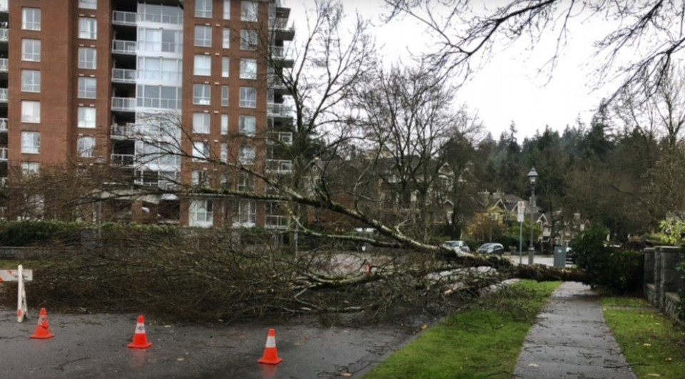
The weak tornado that touched down at University Golf Club a year ago this Sunday came as a blessing to Prof. Roland Stull.
He teaches a meteorology of storms course at University of B.C.’s Earth, Ocean and Atmospheric Sciences Department and the extreme weather event became an easy addition to the curriculum.
“The tornado came from a supercell thunderstorm, where the whole thunderstorm was rotating as a mesocyclone,” Stull said. “These storms are very rare for Vancouver.”
Indeed, the previous Vancouver tornado had been in 1976.
Eyewitness video emerged quickly from the driving range of swirling winds and broken branches. A few large trees fell across University Boulevard, temporarily snarling trolley bus service in Point Grey. Environment Canada assigned it an EF-0 rating and estimated winds blew at 90 km-h to 100 km-h when it touched down at 5:10 p.m.
Campus surveillance video released from UBC under freedom of information shows what happened 2 kilometres west of the golf course: wind, heavy rain and hail.
Graupel, to be precise, according to Stull.
“The atmospheric ingredients were there for this kind of rotation to develop,” said Dave Sills, a former Environment Canada severe weather scientist who is co-leader of the National Tornadoes Project (NTP) at University of Western Ontario.
“It was just a little bit of enhanced rainfall among a large area of rainfall and then it really started spinning up just west of the airport,” Sills said. “Then we could see the reflectivity, which is the radar echoes that show you how intense the rainfall is. It really took off once it approached University Hill, and that’s indicative of hail, so I’m glad to see that there’s evidence of hail there.”
Indeed, the images show graupel blanketing sidewalks, streets and grass around the campus while trees and bushes swayed in the wind, sometimes violently reacting to gusts. To the east, there are moments of black clouds briefly darkening the skies.
The tornado started west of Vancouver International Airport, over the Strait of Georgia.
NTP found reports of damage around Southwest Marine Drive, West 16th Avenue, West 10th Avenue, Chancellor Boulevard and Northwest Marine Drive.
“That ended up being track length of 3.9 or so kilometres with a maximum path width of 310 meters, and that was pretty much coming straight up from the south,” Sills said. “It’s 190 degrees, so it's a little bit west of south but almost straight from the south with the supercell thunderstorm that developed over the water. It just kept going north.”
The storm was detected around University Hill at 5:08 p.m. A secondary area of rotation occurred to the northwest late in the hour.
The storm system continued traveling across to the North Shore, but Sills said the only hint of damage there was a power outage due to a downed line on Cypress Bowl Road. He doesn’t know for certain that the storm was to blame.
It dissipated but then the rotation redeveloped just north of Grouse Woods in North Vancouver.
“This is a bit of a unicorn. It was late in the season and just tornadoes in general in Vancouver are pretty rare,” Sills said.
NTP and its new companion, the National Hail Project, are based at UWO in London, Ont., with a mission to detect, document and assess data about the respective weather phenomena across Canada.
No repeat in Vancouver this year, but Sills said there were reports of a dust devil in Prince George and a vortex on the Sumas Prairie near Abbotsford. “Pretty quiet as far as downbursts and tornadoes in B.C. in 2022.”
The Nov. 6, 2021 tornado was part of the wildest weather year in memory for B.C., that included the late-June heat dome in which 619 people succumbed and mid-November parade of
atmospheric rivers that flooded Fraser Valley farms and destroyed stretches of the Coquihalla Highway.


