Heavy rainfall is expected in parts of southern Ontario and Quebec as Environment Canada warns remnants of Hurricane Beryl could cause downpours starting late Tuesday or Wednesday.
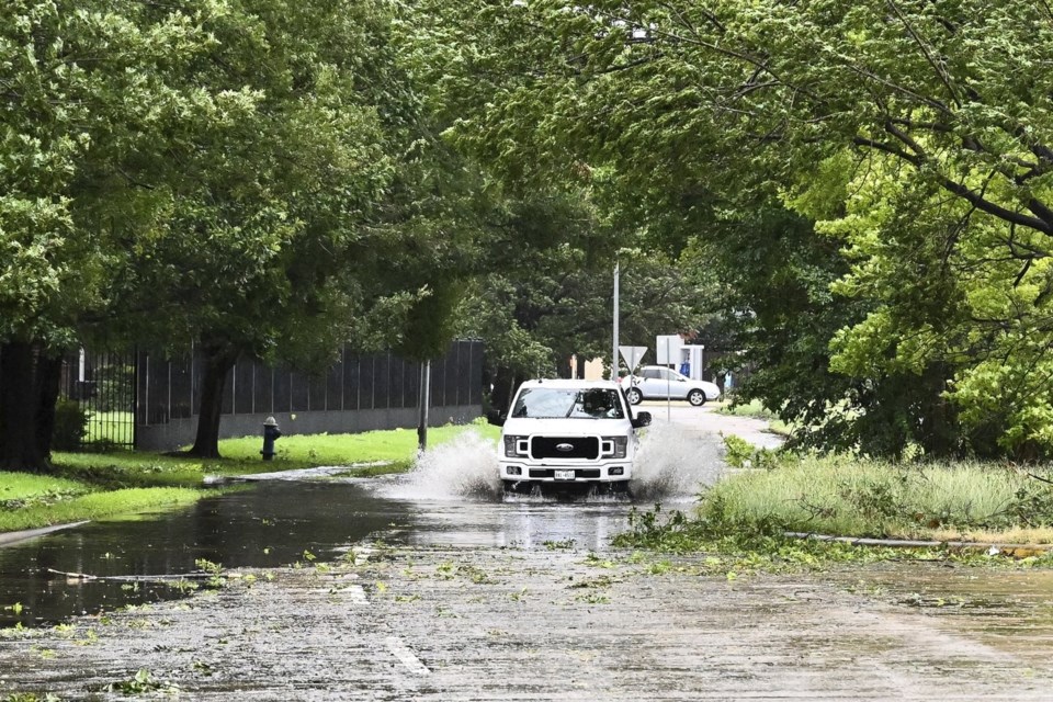
The weather agency issued a series of rainfall warnings Tuesday, with Toronto residents told to expect "torrential" rainfall of up to 40 millimetres per hour, while localized flooding is possible for Montreal.
The warnings for Toronto and surrounding areas say the rain will last until early Thursday, with some areas expected to receive up to 80 millimetres.
Environment Canada meteorologist Trudy Kidd said it's tough to predict the exact track of the weather system caused by the hurricane, but stressed it could lead to significant rainfall.
"We're expecting the remnants of Hurricane Beryl to begin impacting southern Ontario overnight tonight," she said on Tuesday.
"Then later (Wednesday) morning, like 6 a.m. to 9 a.m., give or take, we'll expect to see rain in the GTA and then by the afternoon we'll see rain in eastern Ontario."
Kidd said heavy rain expected on Wednesday will continue for most areas overnight, possibly into Thursday.
"We're also expecting a risk of thunderstorms along with this system. So, any areas that receive thunderstorms or multiple thunderstorms or really slow moving thunderstorms could really see quite high rainfall amounts," she said.
A blistering heat wave is producing record temperatures and the threat of wildfires across Western Canada.
More than two dozen daily high temperatures were broken in B.C. on Monday as the mercury topped out at 42.4 C in the Interior community of Lytton.
Environment Canada meteorologist Jennifer Smith said a ridge of high pressure from Northern California crept into British Columbia on the weekend before invading the Northwest Territories and Alberta on Monday.
She said the heat will travel into Manitoba by Wednesday and may reach the edge of the northwestern Ontario border before it moves south into the United States again.
Smith said they're watching for things that lead to wildfires: hot and dry conditions, wind and lightning without rain, something that is in the forecast already for parts of B.C.
Environment Canada says temperatures are expected to moderate in parts of B.C. including Metro Vancouver and inland sections of the north and central coasts on Tuesday night, but it will remain hot in the Interior.
A separate heat wave sent temperatures into the 30s in Atlantic Canada and parts of Ontario during the day on Tuesday.
This report by The Canadian Press was first published July 9, 2024.
The Canadian Press


