A menacing wildfire burning more than 124 square kilometres between Spences Bridge and Cache Creek sent a tower of smoke more than 20,000 feet in the air.
The Shetland Creek fire is estimated at 12,402 hectares and the blaze is expected to continue its run north toward Ashcroft on Friday.
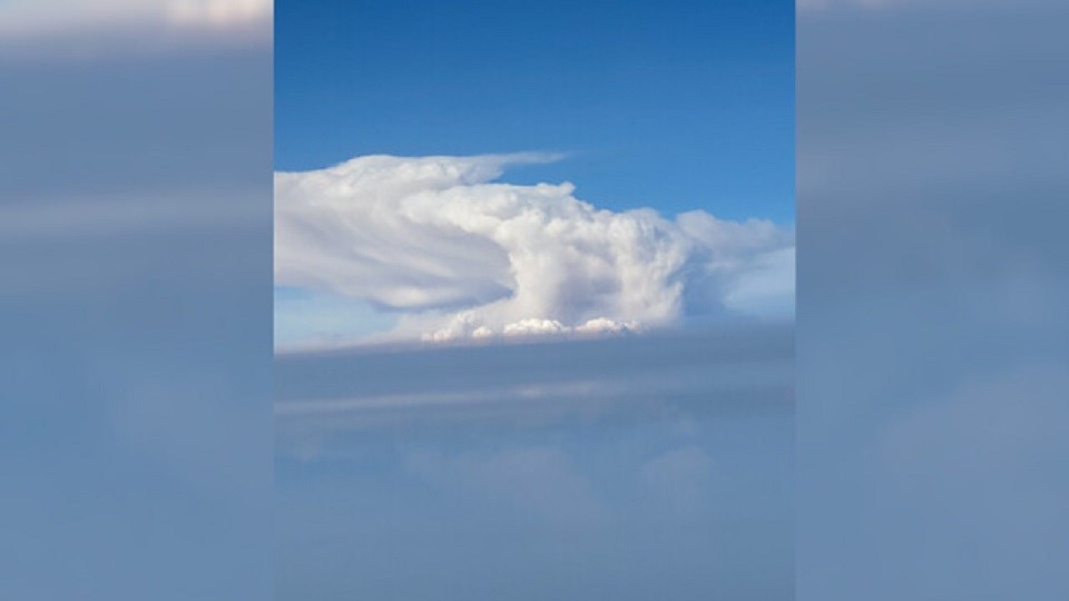
Robert Gray, a wildland fire ecologist, was on a flight over the Fraser Valley at 5 p.m. on July 18 and noticed the plume of smoke.
"For the smoke to reach that altitude the fire has to be generating a lot of energy,” he says.
"That energy is coming from fuels which are very dry, thanks to the persistent drought we've had.”
Gray took a photo of the smoke when the aircraft was at an altitude of 20,000 feet, and the height of the smoke was significantly higher than the plane.
The Shetland Creek wildfire has resulted in 85 properties in Venables Valley being under TNRD evacuation order, as well as dozens more on Cook’s Ferry Indian Band land.


