Another weather statement of potentially strong winds for the upcoming week has been issued as witnesses of the giant water spout, which occurred near the Vancouver International Airport, are still revelling in the dramatic footages.
Environment Canada announced in a special weather statement that strong winds of up to 90km/h are in the forecast for Monday night and Tuesday.
"The exact track and strength of the weather system is still uncertain. Any changes in the evolution of this system can affect the timing and strength of the winds," reads the statement.
The weather statement is in effect for most of Metro Vancouver including:
- Richmond and Delta
- City of Vancouver Burnaby and New Westminster
- North Shore including West Vancouver and North Vancouver
- Coquitlam and Maple Ridge
- Surrey and Langley
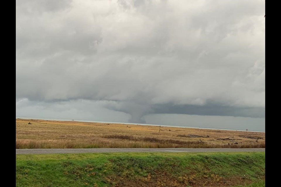
According to the National Ocean Service, a waterspout is a “whirling column of air and water mist” that appears over a body of water, whereas tornadoes tend to occur over dry land.
If a water spout formed on water and moves onshore, then it “technically becomes a tornado.”
Saturday's rare water spout occurrence was a sight to see, however, it also created a mess in certain areas of Metro Vancouver.
A video posted on Reddit also showed debris and branches being flown around at the UBC Vancouver campus due to the strong winds in the area.
Meanwhile, public transit in the UBC area has also been impacted due to fallen trees on University Boulevard from Blanca Street to Wesbrook Mall.
"Our crews are working hard to restore service as they wait for the City of Vancouver to clear the large number of fallen trees. We have been advised, this could take several days, until regular access is opened to traffic on this route," said TransLink in a media statement.
Videos and photos were shared across social media platforms, some even shot by passengers at the airport. Many were taken from high rises and one even across the dike trail in south Richmond.
-with files from Alan Campbell
