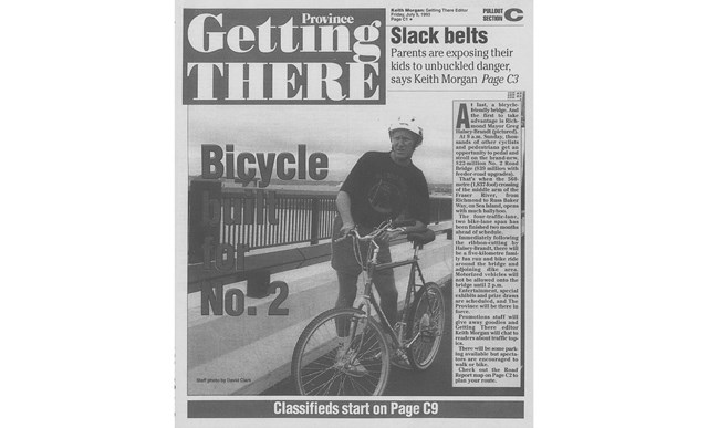
It was a sunny Sunday morning. Spirits were high as a crowd of people waited to be among the first to cross Richmond’s newest bridge.
At 9 a.m. on July 11, 1993, the mayor at the time, Greg Halsey-Brandt, cut the ribbon draped across the No. 2 Road Bridge. Politicians unveiled a plaque, souvenir T-shirts were sold for $10, and walkers, runners and cyclists made their way across the four-lane concrete span.
“There was a big cheer. Everyone was just full of beans. We opened it and ran across. A couple hours later there were cars driving across it. It just became part of the infrastructure,” said Halsey-Brandt, who remembers jogging at the opening celebration.
Halsey-Brandt said it was likely the biggest capital project the city had ever undertaken to that point, and it made an immediate impact on traffic flow in west Richmond.
Before the No. 2 Road Bridge, the two-lane Dinsmore Bridge was the only span connecting the west side of residential Richmond with Sea Island and the Arthur Laing Bridge. Rush hour lineups to cross the Dinsmore would stretch well down Gilbert Road and jam feeder routes of Westminster Highway and River Road.
“And then poof, it all disappeared overnight,” said Halsey-Brandt. “The vast majority of traffic shifted over to the (No. 2 Road Bridge).”
Besides its low-level design, what made the Middle Arm bridge unique was its financing model. It was the City of Richmond that paid for it — unlike other major crossings bankrolled by federal and provincial governments.
The province did end up contributing $5 million, but that represented just one-eighth of the total $39-million cost for the bridge and related road construction.
To raise the needed capital, the city borrowed cash and paid it back over two decades through road development cost
charges. The borrowing scheme was deemed a success. City council recently used a similar model — this time to finance the Minoru Complex pool and seniors centre.
Halsey-Brandt said he campaigned on a four-lane bridge, whereas rival Gil Blair pushed for a less expensive, two-lane span.
“Nobody objected to the four-lane. No one could believe that you would actually build a two-lane (bridge). This was 1990,” he said. “I think it’s worked pretty well for the folks on the west side.”
The girder bridge is 560 metres long and 22 metres wide, according to Alan Dawe’s book Richmond and its Bridges. Its 10 spans rest on 217 concrete piles. The bridge has a relatively low profile, giving it a seamless flow with connecting roads and avoiding interference with Middle Arm seaplane traffic.
Apart from four vehicle lanes, the bridge also has bicycle lanes and a wide, separated sidewalk for pedestrians, complete with lookout areas.
It also links to dyke pathways with ramps rising from both sides of the river. That accessibility stands in stark contrast to the Dinsmore Bridge and its narrow, shared sidewalks.
As for its name, the vanilla moniker of No. 2 Road Bridge has been the subject of much discussion in its 23 years. In his book, Dawe notes it’s “not the most poetic of names.”
But the city did survey the public, and despite some interest in honouring the Blair name or Lulu Island, the majority of respondents opted for the current, explicit name.
Still, that hasn’t stopped the suggestions. Five years ago, Richmond’s late Norman Wrigglesworth asked council to name the crossing after Second World War hero Ernest “Smokey” Smith, and more recently a Richmond News letter-writer suggested Rick Hansen should be honoured.
To be certain, the span doesn’t match the greatness of the Golden Gate or the proportions of the Port Mann, yet it’s still one of the city’s biggest capital projects that now leads to the heart of the new Oval Village.
It’s also well-used.
“I don’t believe I ever had criticism from one person who said you wasted our money,” said Halsey-Brandt. “You take shots for ice rinks, city halls and God-knows-what, but on that bridge I don’t think I ever had a negative comment at all.”


